拍品 187 - A202 书籍&手稿 - Mittwoch, 21. September 2022, 02.00 PM
ATLASES -
Ramusio, Giovanni Battista.
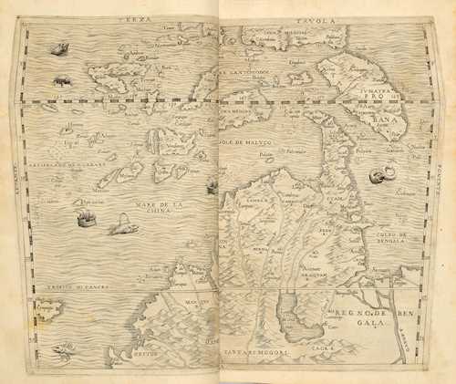
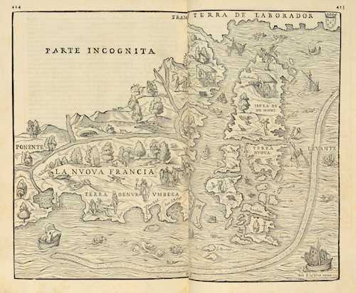
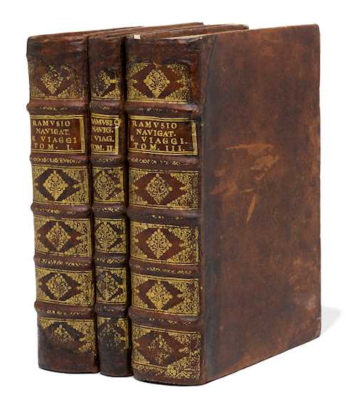
Delle navigationi et viaggi. 3 volumes. Mixed edition. With 3 double-sheet copper maps, 9 (6 double-sheet) woodcut maps (in the pagination), 1 double-page illustration and 46 woodcuts in text (some in sheet size). Woodcut printer's marks on the titles and 2 printer's marks at the end.
Venice, Giunta, 1563, 1559 (in fine: 1558) and 1565. Folio (31.5 × 22 cm). [4], 34, 394 (recte: 395) pp., [1] w. p.; [2], 28, 155 pp. (counting incorrect), [1] pp; [6], 34, 456 pp. 18th century leather bindings with gilt spine titles and rich spine gilding (neat restorations to the capitals, resulting in small losses to the gilding).
Edit16 CNCE 27274, 27248 u. 27293 - Adams R 136, R 137 u. R 140 - Borba de Moraes II, 698-99 - Church 99 - Cordier BS 1939 - Cox I, 28 - Sabin 67732, 67739 and 67740. - The first volume in third edition (first 1550), the second volume in first edition, the third in second edition (first 1556). - The most important collection of 16th century travelogues before de Bry, with numerous previously unprinted sources and significant map material. "The publication of Ramusio's Raccolta may be said to open an era in the literary history of Voyages and Navigation. Instead of accounts carelessly copied and translated from previous collections, perpetuating errors and anachronisms, we find in this valuable work original narrations judiciously selected, carefully printed, and enriched with notices which betray the hand of a scholar with great critical acumen" (Harrisse). Volume 1 contains the early Portuguese voyages in Africa and Asia, a full-page woodcut map of the sources of the Nile and 3 south-oriented copper maps of Africa and southern and southeastern Asia, all by G. Gastaldi. Volume 2 deals mainly with European Russia, Central and East Asia and contains "the best older printed edition" of Marco Polo's travelogue (Walravens 44). Of particular importance is the third volume, which is almost exclusively devoted to America and is the most richly illustrated. Included are 6 more Gastaldi maps (in woodcut), including a complete map of the Western Hemisphere (with Japan as "Giapam"), "Nuova Francia" (New England and Canada), u. Brazil; furthermore (not by Gastaldi) view of Cusco in Peru and the first printed plan of Montreal (this bound in at the end and with backed tears and marginal tears). - Volume 1 with continuous dampstain in the upper third, getting stronger at the end; otherwise only slightly browned and a little marginal staining in places. - Provenance: erased ownership note by old hand on titles, ex-libris of Friedrich Sarre (1865-1945), the founder of Islamic archaeology and art history in Germany. Other modern ex-libris on mirrors.
CHF 14 000 / 20 000 | (€ 14 430 / 20 620)
以瑞士法郎銷售 CHF 28 360 (包含買家佣金)
所有信息随时可能更改。


